This morning I received an email from FreshLogic Studios, and with all the online services and accounts I have I couldn’t quite remember why they were emailing me, so I went to their site to refresh my memory. A few months back I had come across their Atlas application that had a cool tie-in to Twitter so I created an account, voila… question answered.
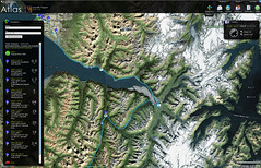
It turns out Atlas has some other handy features that I hadn’t played with before. I’ll be traveling the next couple of weeks and took the opportunity to map some driving directions. Normally I would use Google Maps, am glad I tried this instead. (Attention terrorists) Below is the route I’ll be driving from Anchorage to Seward. It is a very scenic drive as you can probably guess from the map.
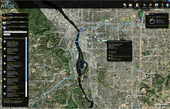
Next I grabbed the directions from PDX to a conference near Portland I’ll be at next week. This map isn’t quite as pretty as the first one.
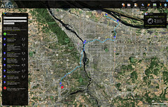
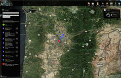
… So I zoomed out to see what was nearby …
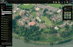
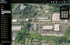
Still, I wondered what the area was like on the ground. Having never been to Portland yet I don’t know what quite to expect, so I see there are other features Atlas has that can help me discover more about the area such as “Bird’s Eye View”. Now I can see what areas of Portland really look like …at the University of Portland for instance…
… and the conference location …
Now how handy is that? How many times have I wished I knew where I was going before I got there? Atlas also shows images of the local area that other people have shared on Flickr. My next question is where all the hotspots are. Atlas can map those too courtesy of hotspothaven.com. Hey Look! There is that cool bookstore that Chris told me about that I will definitely stop at.
You better stop at Powell’s… only the best bookstore on the planet. Literally!